
Imagine standing on a beach in Peru in late 2026, watching the ocean feel noticeably warmer than you remember. Fishermen nearby are pulling in unusual catches, and meteorologists thousands of miles away are watching satellite data with growing concern. Something is shifting beneath the surface of the Pacific Ocean, and it’s about to influence weather patterns across the globe.
The Super El Niño 2026 is now officially underway, and it’s already shaping forecasts for the rest of this year and into 2027. But what does “Super” actually mean here, and why should it matter to you?
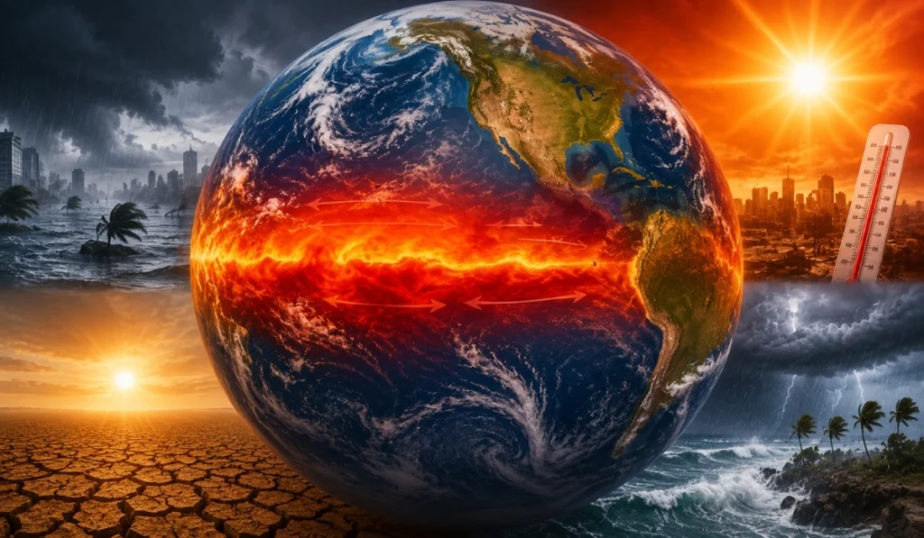
What Makes an El Niño “Super”?
Most explanations stop at “the ocean gets warmer.” But the real story is about scale, and scale changes everything.
El Niño is declared when sea surface temperatures in the central and eastern tropical Pacific rise at least 0.5°C above average for several consecutive months, shifting trade winds in a pattern that typically lasts nine to twelve months and drives global weather. A “Super” El Niño involves anomalies of 2°C or more — a difference that represents an enormous amount of stored heat energy entering the atmosphere.
This week, NOAA’s Climate Prediction Center placed the odds of this event becoming a “very strong” El Niño at 63%, with some models suggesting it could rank among the strongest ever recorded. The driving force is a massive pulse of warm water moving beneath the ocean’s surface, known as a Kelvin wave, now rising toward the surface and beginning to reorganize weather patterns starting in the tropics.
How Pacific Ocean Temperatures Shape Weather Worldwide
Here’s the part that tends to surprise people: a patch of warm water near the equator, thousands of miles from most population centers, can change whether your winter is wet or dry, whether hurricane season is busy or quiet, and even how likely wildfires become on the other side of the world.
When that warm water rises, it shifts where rain clouds form over the Pacific. Air that normally rises over Indonesia and Australia instead rises further east, nudging the jet stream — the fast-moving river of air that steers storm systems across continents.
In the United States, the Super El Niño 2026 tends to follow a fairly consistent pattern:
- Southern states get wetter – A stronger subtropical jet stream pushes more moisture into California, Texas, and Florida, often bringing a wetter winter.
- Northern states get warmer and drier – While the south soaks, northern regions often see milder, drier conditions than usual.
- Atlantic hurricanes tend to quiet down – Stronger El Niño events increase wind shear over the Atlantic, suppressing storm formation.
- Pacific hurricanes often pick up – The same warm water that calms the Atlantic tends to energize storms in the central and eastern Pacific.
None of these are guarantees. Every El Niño has its own personality, shaped by other ocean patterns happening at the same time. But the stronger the event, the more likely these effects appear.
Regional Impacts: From Drought Relief to Flood Risk
If you live somewhere stuck in drought, this part might sound like good news, with caveats.
Take Colorado, which has spent recent years locked in a stubborn dry pattern. Climate experts note that El Niño tends to bring wetter-than-average conditions to southern Colorado, particularly in fall and spring. One state climatologist called this a “tentative dose of hope,” while cautioning that conditions may worsen before improving, since consecutive La Niña years have deepened the drought.
Along California’s Central Coast, the contrast could be dramatic. Forecasters near Santa Barbara and San Luis Obispo are tracking the possibility of seasonal rainfall reaching 40 to 50 inches instead of the typical 14 inches, with the heaviest impacts expected in winter 2026 into 2027.
“More rain” isn’t automatically a simple win, though. Regions accustomed to dry conditions can struggle to absorb sudden heavy rainfall, leading to flooding and landslides — a reminder that climate patterns redistribute extremes rather than simply removing them.
Why This El Niño Could Push Global Temperatures Even Higher
Beyond rearranging rainfall, El Niño tends to nudge global average temperatures upward for a year or two, layering on top of the long-term warming trend already underway.
Scientists note this added boost makes it increasingly likely that 2027 could surpass 2024 as the planet’s warmest year on record. This happens because El Niño releases heat stored in the deep ocean back into the atmosphere, briefly amplifying warming from other causes.
El Niño itself is a temporary, natural cycle that has occurred for thousands of years and will eventually give way to its cooler counterpart, La Niña. But when a strong natural warming cycle stacks on an already-warming baseline, the combined effect can feel unprecedented, even though the cycle itself is nothing new.
What Happens Next
Right now, the world is watching a slow-motion handoff. The ocean has shifted from a cooling La Niña pattern into a warming El Niño pattern, and the atmosphere is just beginning to respond. Models currently put the odds of El Niño persisting through the core of winter at around 96%, meaning the real question isn’t “if” anymore, it’s “how strong.”
For most people, the takeaway isn’t to panic over any single forecast. It’s to pay attention as the picture sharpens over the coming months, especially if you live in a region known to be sensitive to these patterns, such as coastal California, the southern U.S., the Amazon basin, or Southeast Asia.
What’s most fascinating is how something happening in a remote stretch of ocean can ripple outward to shape whether someone on the other side of the planet needs an umbrella, or whether a wildfire season turns dangerous. The next time the news mentions the Super El Niño 2026, you’ll know it’s not just weather jargon, it’s the echo of something much larger, still unfolding beneath the waves.
This article is for general informational purposes and reflects forecasts and expert commentary available as of June 2026. Climate predictions carry uncertainty and can change as new data becomes available.